Showing posts with label Hiking. Show all posts

Monday, October 29, 2012

The Mist Trail

One of the highlights of the hiking season for me is the hike to the top of Nevada Falls in Yosemite via the mist trail.  When we did this two years ago Hubby had a lot of trouble.  People would stop him and ask "are you OK?"  He made it up and down but we decided that would be the last time he would undertake such a demanding hike.  We thought it was his age, he was 75.  We were wrong.
Jules now                                                                                 Jules two years ago

It wasn't his age, it was his weight.  Now, 35 pounds lighter he was ready to try again.
Off we went.  The trail starts out pretty easy, paved with a nice wall to keep one from falling off the edge.  It is a bit steep, even at this point and can be very hot in summer months.

At the first bridge there is a nice view of Vernal Fall.


Then the trail heads up, up some steep steps carved out of the granite.

There can be a bit of a traffic jam.


Finally the trail goes along the cliff  and then up to the top of Vernal Fall.


The reward for making it this far is lunch where Silver Apron flows into Emerald Pool.
After lunch we hit the trail again and cross the Merced River for the second time.


Then it is up more granite steps, some with a view of Nevada Fall.  This is where other hikers became concerned about Hubby's well being on our previous hike.  No problem this time.  Sure, it was strenuous and we felt it, 1,900 feet is a lot of up.


Once at the top we always find it was well worth the effort.


This backpacker even found himself an easy chair!  It looks like he brought along an e-book as well.  All the comforts of home.


Now we cross back to the other side of the Merced.  We didn't want to take the steep Mist Trail back down.  The John Muir trail is gentler but not as interesting.


We look back at Liberty Cap on our way down.  Just one of the many granite domes for which Yosemite is so famous.


A few late autumn flowers still grace a weeping wall along the trail.


And we look back frequently, not wanting to miss the spectacular views of Nevada Fall.


Will we make this hike again next year?  We hope so but the day may come when age will be the factor that keeps us on the valley floor.

You will find more views of our wonderful world at Our World, Tuesday.  Hosted for us by Arija, Gattina, Lady Fi, Sandy and Sylvia.

Monday, August 20, 2012

Hiking to May Lake

It was hot the first week in August, even at 9,000'.  We wanted something different but we didn't want to do one of our lower elevation hikes where it would be even hotter.  We decided to go into Yosemite and try a hike off the Tioga Road.  Forget Mono Pass, every parking space was taken at the trail head.  We headed for May Lake.
Even here, two miles up a narrow one lane with turnouts we were lucky to find a place to park.  No surprise, I guess, this is Yosemite and it's tourist season.  The view from the trail was spectacular.  Cathedral peak on the left and Unicorn to the right of it.  The gray granite, scoured by glaciers has little vegetation.
May Lake lies in a cirque at an elevation of over 9300'.  The hike is not bad, about a mile and a half with less than 500' gain.
 My lens couldn't capture the view so I stitched five images into a panorama.  This is the view that would great you in the morning if you stayed at the May Lake High Sierra Camp.
There are five of these High Sierra Camps spaced 10 miles or less apart.  Guests get a heated tent, a cot, blanket and pillow (may have to share tent with strangers).  Breakfast and dinner are included.
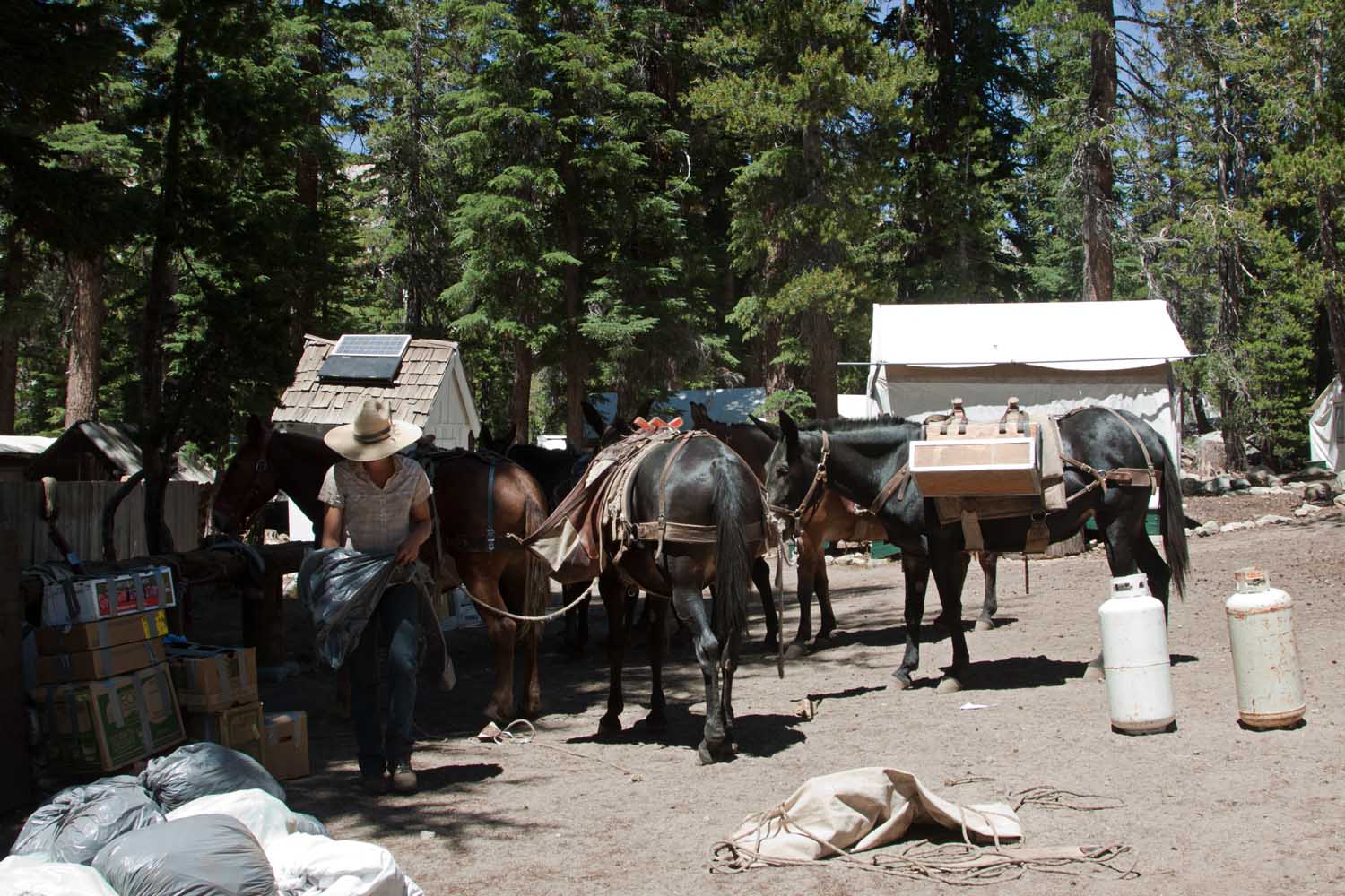
Since this is wilderness, all of the supplies must be packed in and the trash packed out without mechanical devices.  High Sierra Camps are a way for people who don't feel able to carry a heavy backpack to experience the wilderness.

See more views of our magnificent world at Our World, Tuesday.  Hosted for us each week by Arija, Gattina, Lady Fi, Sandy and Sylvia.

Tuesday, October 5, 2010

Wet Dog


Jingles enjoyed a romp in Skelton Lake

Find more watery sites at Watery Wednesday, hosted for us by 2sweetnsaxy.

Sunday, October 3, 2010

Duck Pass Hike

While in Mammoth Lakes I hiked with friends up towards Duck Pass.
The hike begins above Lake Mary and follows along a pleasant stream.
 It goes past Arrow Lake and then Skelton Lake.
 At Barney Lake we stopped for lunch.  We looked at the pass.  No one was enthusiastic about going over the pass to Duck Lake.
 I propped my camera on a rock for a group photo.  It was an odd angle and I tripped running to get into the shot.  I made it on the second try.  I'm the one on the left.
 Back at the trailhead we explored what remained of the Mammoth Consolidated Mine.
This hike starts here, at the trailhead parking at the far end of the Lake Mary Campground.

You can find more world views at My World Tuesday, hosted for us by Klaus, Sandy, Wren, Fishing Guy and Sylvia.

Saturday, October 2, 2010

Wet Shadow

I hiked with friends up towards Duck Pass in the Mammoth Lakes area.  As usual I was on the lookout for shadows.  I found this one at Skelton Lake.
Where is this?  The link will bring up a map.

There are more shadows to be found at the Shadow Shot Sunday meme, hosted for us by Tracey in Brisbane.

Monday, August 30, 2010

Saddlebag Lake--My World

Many years ago, when I was about 12, I saw a travel log about a place called Saddlebag Lake.  I was enchanted by its rugged beauty but I felt I was unlikely to ever see it in person.  Little did I know that someday it would be practically at my back door.
It is about 25 miles from our cabin by car, much closer if I had wings.  When our son Mark came to visit in early August he suggested that we cross the lake on the Water Taxi and hike around Twenty Lakes Basin.  I'm always ready for this trail though not quite as excited as this spaniel who was also going on the boat.  The sign said "no wet dogs allowed".  Well, you can't keep a spaniel out of the water but no one objected.
There are few glaciers remaining in the Sierra and Conness here in the distance is one of them.  It is rapidly being reduced to a snowfield.  We didn't hike to the lake below it this trip but the last time we were there it had the tell tail turquoise color of a glacier fed lake.  These boulders, called erratics,were left by the glacier 
long ago when it filled the basin.
What trees there are here are small, there's little shade to be found.
Here the granite reigns.
Lovely meadows flow with small streams and are strewn with wildflowers.
Sometimes the flowers cling to a bit of soil in the stream.
We stopped often to take pictures and enjoy the landscape.  Then we checked our watches and realized the time was short to make our appointed time for the return trip.  The last mile and a half were done with no stopping for pictures and this old lady pushed to her limit.  We made it, though.  I didn't want that extra mile walk to the far side of the lake.


Saddlebag Lake is a few miles off the Tioga Road just east of Yosemite National Park. 


Check out more parts of this wonderful world at
hosted for us each week by
Klaus, Sandy, Wren, Fishing Guy and Sylvia.

Monday, March 22, 2010

Hiking Palm Canyon—My World

Another hike in Anza-Borrego is the hike from the campground up Palm Canyon to the oasis.

stream

The trail follows the stream up canyon.  There was quite a bit of water in the upper portions.  Down stream the thirsty gravel had left only puddles.

Brittlebush


There was brittlebush and ocotillo in the lower, drier portions of the trail.     


Bever tail 

We were a little to early to see this Beavertail in bloom.

globe mallow 

This Desert Mallow was blooming though.

Mojave gold poppy

Arizona Lupin

There was quite a variety of flowers in the canyon.  I think these are Mojave Gold Poppy and Arizona Lupine.  There are so many similar varieties that I could easily be mistaken.Oasis 1

Some lovely cascades as we approach the end.

Oasis 2

And then the palm oasis.  The skirts of old leaves protect the trunk from the harsh summer heat.  It was an easy hike except for some places where the trail and bridge had been washed out.

Find more views of the world at My World Tuesday, hosted for us by Klaus, Sandy, Wren, Fishing Guy and Sylvia.

Hiking to Panoramic Overlook

This is a short hike in Anaza-Borrego, short but a bit steep.Panoramic-Overlook-Trail Partway up there is a viewpoint for those that don’t want to go all the way.

Mohavea-confertiflora2-Ghos I saw this beauty along the trail and didn’t see it anywhere else.  It took me some time to identify it, Ghost Flower, Mohavea confertiflora.

Panoramic Overlook The view at the top was even better.

Monday, November 9, 2009

Bishop Pass Trail--My World

This is the last of my summer Sierra hikes to share with you. We hiked the Bishop Pass trail in September while camping on Bishop Creek
It was our favorite trail when we lived in the area and the trail head is a popular site for this group of local plein air painters.
The trail begins at South Lake and soon enters the John Muir Wilderness.

One of the great things about hiking in the eastern Sierra is the wilderness.

A string of wilderness areas stretches up the Sierra crest for 150 miles, crossed only by the Tioga Road in Yosemite. You can hike for over two hundred miles on the John Muir Trail and not cross a road.
From 9800' the trail climbs steadily up to Bishop pass at 12,000'. We would often, in our younger days, hike up to the pass but today we only planned to go as far as Long Lake.
Just before Long Lake the trail forks. You can make a loop to Bull Lake and Chocolate lake, rejoining the main trail at the far end of Long.
I asked a hiker who was on his way down what he thought of Long Lake. "Like walking through a calendar" he said. I wondered what he would have thought had he seen it in July with thunder clouds building and wildflowers everywhere
It was pretty, though.
Hubby stopped at Long Lake but I went a little further, up to Spearhead Lake. The flowers were gone but the willows were turning yellow and gave some color to the scene.
The rocks and Chocolate peak had plenty of color as well.
A good day hike, over six miles round trip and 1,000' gain. Maybe next year I'll go all the way to the pass and step into Sequoia.

To see more parts of this wonderful world, click here.